Construction
Subsurface Private Utility Locating
Subsurface Utility Engineering (SUE) and private utility location set a new standard in damage prevention, delivering survey-grade data you can trust before you break ground.
By providing subsurface utility location services we have developed a new standard in damage prevention. Using a combination of equipment including Ground Penetrating Radar (GPR), electromagnetic locators, and detectable sondes and rodders, our teams comply with national industry standards and are trained in the theory and practice of applying subsurface interface radar in engineering and geophysical investigations. We bring those field findings into a survey-grade digital format compatible with almost any CAD program or need, combined with our years of surveying experience and top-of-the-line equipment to give clients SUE grade B data that can be upgraded to level A when needed.
By bringing private utility locations in house we have eliminated the loss of information as it passes through multiple hands and developed a premier private utility location service capable of handling everything from single-line locates to entire manufacturing plants and energy projects. We have the professional staff and resources to maintain continuity on any project, delivering quality work on schedule to meet milestones for engineers, developers, and contractors while maintaining the highest accuracy throughout the life of the project.
Defining Subsurface Utility Engineering
Subsurface Utility Engineering (SUE) is the process of identifying underground infrastructure through nondestructive methods. While it can look almost identical to private utility location in the field, the key difference is that SUE technicians record findings far more accurately and can insert them into a variety of CAD and GIS applications to create accurate design plans and as-builts. SUE combines civil engineering, surveying, and geophysics, and utilizes technologies including vacuum excavation and surface geophysics. Private utility location primarily involves marking utilities with paint at active construction sites and home renovations and is typically not recorded with anywhere near the accuracy of SUE. Our teams typically provide quality level B information and, in certain situations, can provide quality level A.
SUE Quality Standards
Quality levels may be thought of as degrees of risk, or how much information is really needed to adequately design and construct a project. The use of quality levels allows project owners to decide what level of information they want to apply to their risk-management challenge and to certify that a certain level of accuracy and comprehensiveness has been provided. There are four recognized quality levels of underground utility information, ranging from Quality Level D (the lowest) to Quality Level A (the highest).
- Quality Level D. The most basic level of information, drawn solely from existing utility records or verbal recollections. It may provide an overall feel for utility congestion but is limited in comprehensiveness and accuracy, useful primarily for project planning and route selection.
- Quality Level C. Involves surveying visible utility facilities (manholes, valve boxes, etc.) and correlating them with existing records. Most useful on rural projects where utilities are not prevalent or not too expensive to repair or relocate.
- Quality Level B. Applies appropriate surface geophysical methods to determine the existence and horizontal position of virtually all utilities within the project limits, surveyed to project control. It addresses inaccurate records, abandoned or unrecorded facilities, and lost references, enabling preliminary engineering decisions that avoid conflicts and produce substantial cost savings.
- Quality Level A. The highest level of accuracy available, involving the full use of subsurface utility engineering services. It provides precise plan and profile mapping through nondestructive exposure of utilities, plus type, size, condition, material, and other characteristics of the underground feature.
Accurate & Comprehensive Field Data
At Blew & Associates we understand the importance of accurate and comprehensive field data. Over our more than 100 years in business, underground infrastructure has become an increasingly prominent part of construction planning, engineering, and surveying. To give clients the best chance of success and develop a new standard in damage prevention, we built our own private utility location team trained in the theory and practice of applying subsurface interface radar in engineering and geophysical investigations.
There are more than 100 billion feet of underground utilities in the United States according to data compiled by the Common Ground Alliance (CGA), and more than 50% is made up of private utilities. The CGA estimated that the societal costs associated with underground facility damages in the U.S. in 2016 were at least $1.5 billion, with an estimated 509,000 utility damages in 2018 alone.
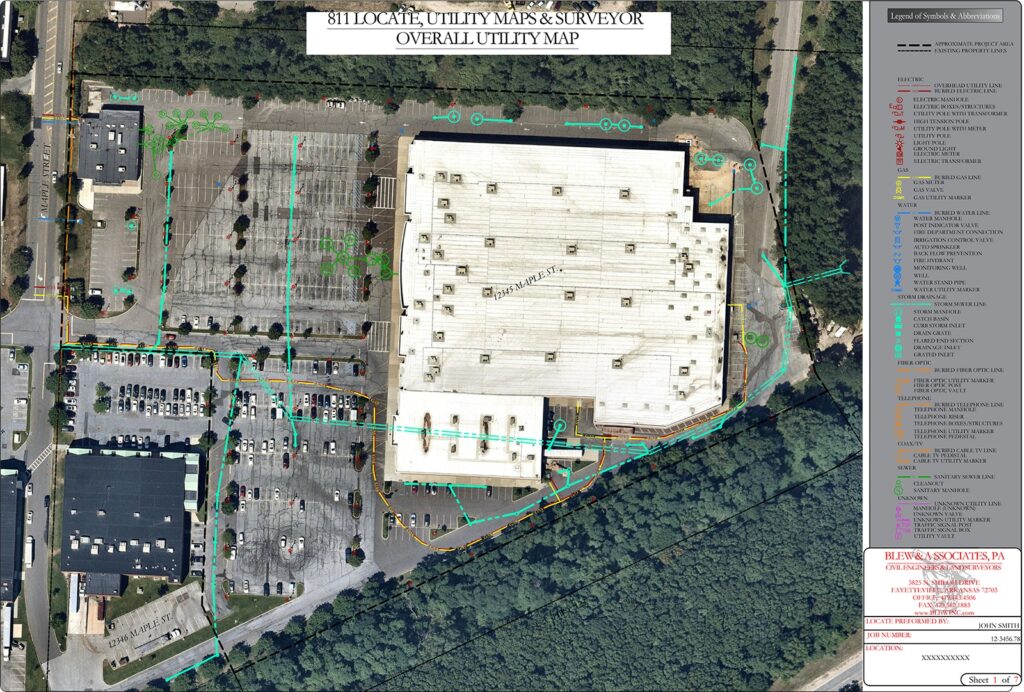
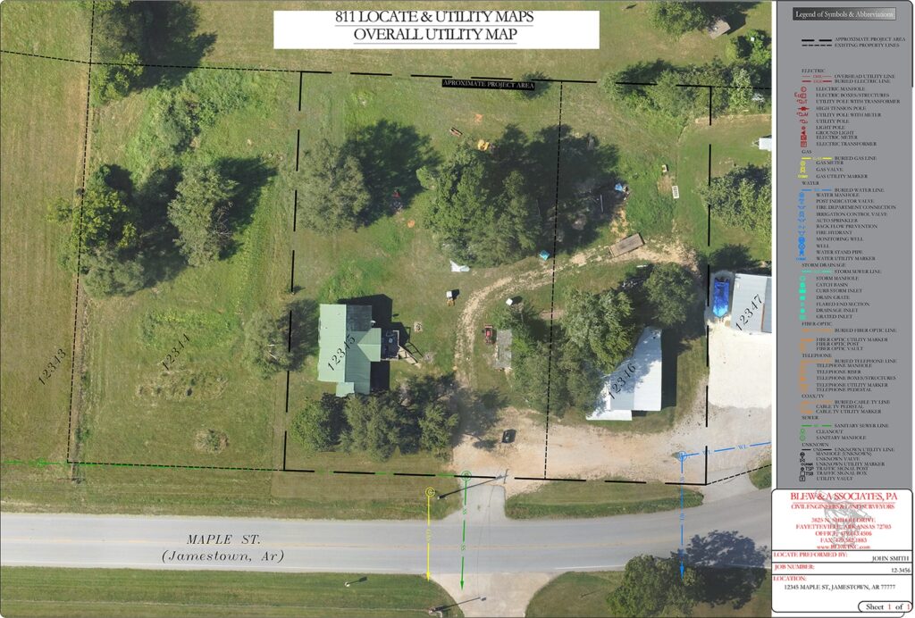
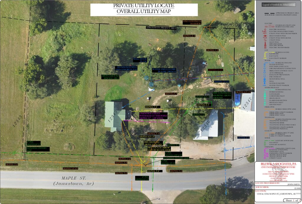
811 is a great tool and the first step to avoiding safety hazards and costly repairs, and should always be called before any excavation. But 811 notifies only the utility owners within your proposed excavation area, relies on records that can be inaccurate, locates only public lines, and field locators typically use electromagnetic locators that detect only metallic utilities. To get a complete view of the utilities present and move forward with confidence, you will likely need one of our private utility location teams. Our locators map all public and private lines within a project area, document findings with survey-grade accuracy using electromagnetic locators, Ground Penetrating Radar, and locating sondes, and can even provide approximate depths in certain conditions.
Commercial
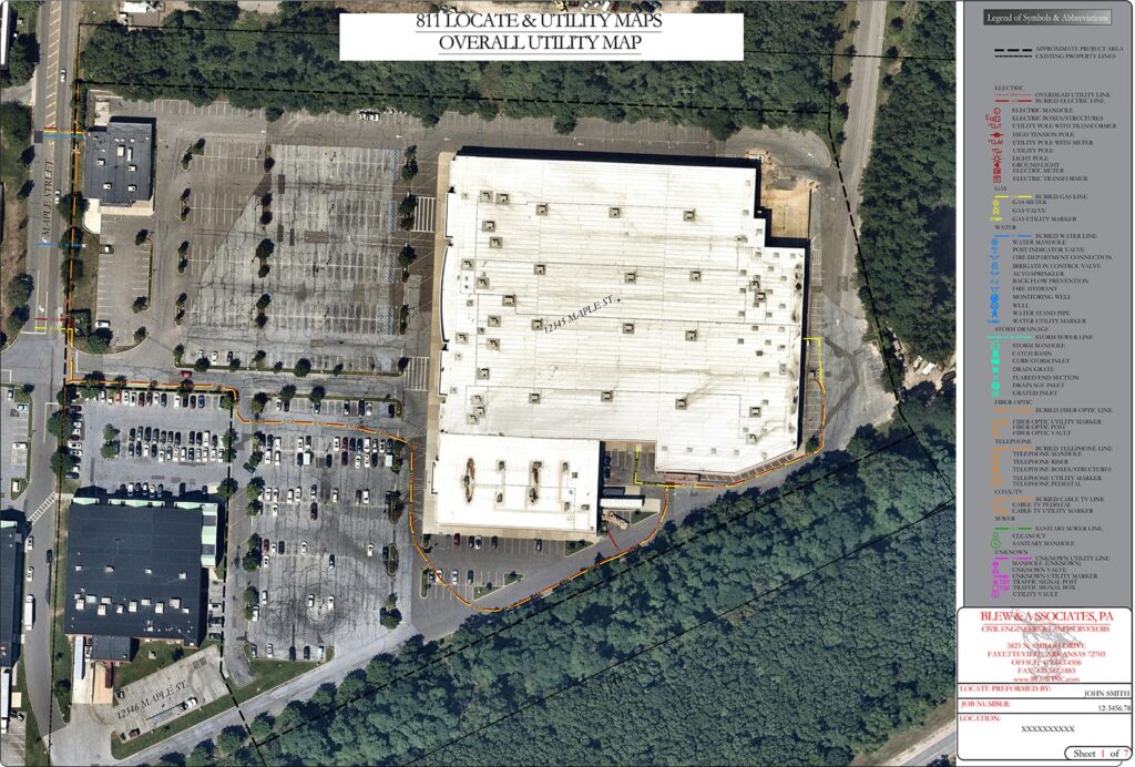 Survey + 811 Hybrid
811 Only
Survey + 811 Hybrid
811 Only
Residential
 Survey + 811 Hybrid
811 Only
Survey + 811 Hybrid
811 Only
Safety & Qualifications
- First Aid & CPR completed by all utility locate technicians
- OSHA 30 completed by all project managers
- All project managers trained in post-processing of GPR data for engineering and geophysical investigations
- Proud member of NULCA, applying best practices to all in-house training
- PACP / LACP / MACP certified
- NULCA-accredited trainer on staff full time for both electromagnetic locating and ground penetrating radar
Our Work